Scenic Views & Parks in San Francisco: Where to See the City at Its Most Extraordinary
April 12, 2026 · TripOnly

A City Designed to Be Looked At
San Francisco occupies 49 square miles on a peninsula between the Pacific Ocean and San Francisco Bay, with another body of water — the Golden Gate Strait — cutting through the northern edge. The city has seven named hills and many more unnamed ones. It has a bridge that is, without serious competition, the most beautiful piece of large-scale engineering in North America. And it has a particular quality of light — filtered through ocean air, coastal fog, and the particular clarity that follows when that fog burns away — that photographers have chased for 150 years without exhausting.
What this means practically is that the viewpoints are remarkable and numerous, that the parks are large and genuinely wild in places, and that the quality of any given view depends enormously on timing. The fog is not your enemy; it is the city's texture. A morning of low cloud that makes Hawk Hill invisible from across the bay might produce, at 11am, a scene of towers rising through the white while the bridge cables disappear and reappear — which is arguably more beautiful than the conventional clear-sky postcard.
Come with comfortable shoes, an extra layer you didn't think you'd need, and patience for the weather. Here is where to go.
The Golden Gate Views
Hawk Hill, Marin Headlands
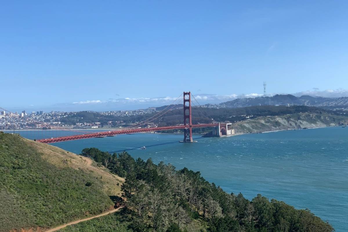
The single best elevated view of the Golden Gate Bridge — and one of the best views of any city from any point in the United States — is not in San Francisco at all. Cross the bridge heading north and take the first exit (Alexander Avenue) toward the Marin Headlands, then follow Conzelman Road as it climbs into the hills. The road offers pull-offs with escalating views as you rise, but the destination is the top: Hawk Hill, 920 feet above the bay.
From the summit you get a 360-degree panorama that includes the Golden Gate Bridge in the foreground, San Francisco spread across the peninsula behind it, Alcatraz in the middle of the bay, the East Bay hills, the ridgeline of Mount Tamalpais, and on clear days, the Farallon Islands thirty miles out in the Pacific. The WWII-era Battery 129 is built into the hilltop — the tunnels and concrete emplacements add a particular atmosphere to the view.
The raptor migration runs August through December, when tens of thousands of hawks, falcons, eagles, and vultures funnel through the headlands on their way south — funnelled here because hawks avoid crossing open water and must pass the Golden Gate as a bottleneck. Volunteers from the Golden Gate Raptor Observatory count and band them daily during this period. If you're there in the right window, there will be hawks in every direction.
Park at the lot before the one-way section of Conzelman Road and walk through the tunnels or take the loop trail to the summit. Free to visit. Leave nothing visible in your car — the pull-offs along Conzelman Road are known targets for smash-and-grab theft.
Best time: September–November for raptors and clear skies. Morning before the marine layer burns off for dramatic bridge-emerging-from-fog shots. Any clear day for the standard panorama.
The Golden Gate Overlook & Battery East Vista, Presidio
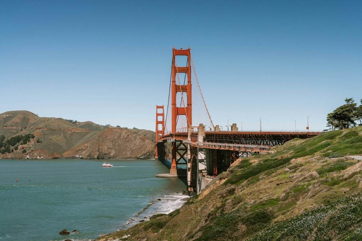
Inside the Presidio — San Francisco's 1,500-acre former military base, now a national park at the northern tip of the city — the Golden Gate Overlook sits directly south of the bridge at close range. The bridge towers rise overhead. The view is intimate rather than panoramic: you are essentially underneath the structure, watching the cables converge above you.
Battery East Vista, a short walk from the overlook, gives you a slightly elevated position with a fuller sense of the bridge's span and the strait below. The new Presidio Tunnel Tops park, opened above the highway tunnels just south of the bridge, has multiple additional viewpoints and a large open lawn — excellent for picnics with a bridge backdrop.
The free PresidiGo shuttle connects the Presidio's major viewpoints from the transit hub at the main post, which makes this accessible without a car. The Presidio Go app has current schedules.
Crissy Field
The restored tidal marsh and promenade along the Presidio's northern shore is the most popular walking and cycling route in the city for good reason: a flat, easy path with the Golden Gate directly ahead, the bay to your right, and the city skyline behind you. The view is wide and unobstructed. In the afternoon, the light comes off the water and turns everything gold.
The restoration of Crissy Field from a paved military airstrip to wetland and beach, completed in 2001, is one of the great urban conservation projects in American history. The East Beach end (near the yacht harbour) gives you the city skyline reflected in calm water; the West Beach end approaches the bridge close enough to photograph the Fort Point arch framing the southern tower.
Baker Beach
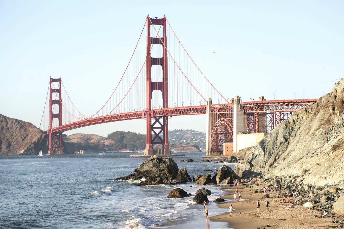
A wide sandy beach on the Pacific side of the Presidio, directly west of the bridge, looking northeast toward the Golden Gate with the Marin Headlands rising behind. The classic view is from the northern end of the beach — the bridge towers above, close enough to feel almost surreal in scale. Cold water, frequent fog, and strong waves make swimming unwise for most of the year, but for watching the bridge from below at sea level, nothing in the city competes. Parking on Bowley Street.
Fort Point
Under the southern arch of the Golden Gate Bridge, Fort Point is a Civil War-era brick fortification — the only one on the West Coast — that survived because the bridge engineers redesigned the southern approach specifically to preserve it. From the upper ramparts, you look directly up at the underside of the bridge deck. The location has a vertiginous quality that photographs can't fully convey. Currently free to enter; check nps.gov for hours and any access restrictions.
The Hills
Twin Peaks
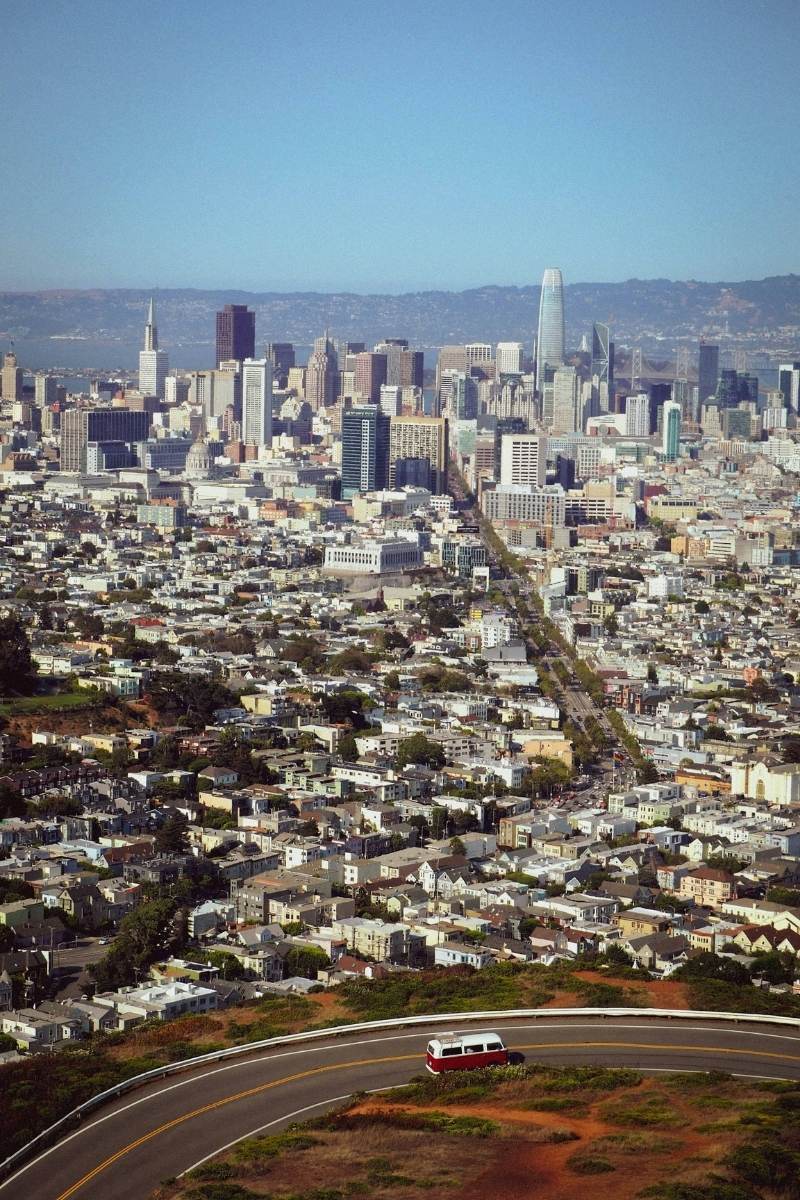
The most famous viewpoint within the city proper: two hills near the geographic centre of San Francisco, the northern peak accessible by a short walk from the parking loop at the top. The view spans 180 degrees of the Bay Area — the Financial District towers, the Bay Bridge, Oakland and Berkeley, the East Bay hills, Marin, and the western ocean. Free, accessible by car or the 37 Corbett bus to the top. Heavily visited; go at sunrise if you want the view without the crowd.
The wind at Twin Peaks is serious — the marine layer funnels through the gap between the hills with considerable force. The layer does not provide warmth; bring one.
Bernal Heights Park
The local alternative to Twin Peaks, better loved by residents than by tourists: a grassy hilltop in the southern part of the city with a nearly comparable panorama and a fraction of the crowd. The view takes in downtown, the Bay Bridge, the Bay, Alcatraz, and on clear days the Golden Gate. An easy one-mile loop trail reaches the summit. The hill turns green and wildflower-covered in winter and spring. Extremely dog-friendly. No parking at the summit; park on Bernal Heights Boulevard and walk up.
The swing: A rope swing that gets tied to a tree near the summit by residents appears and disappears periodically — taken down by the city, rehung by locals. If it's there when you visit, the combination of the swing and the 360-degree view behind you produces a photograph of remarkable whimsy.
Tank Hill
The genuinely secret viewpoint: a small summit at 650 feet behind Twin Peaks that most San Francisco residents — let alone visitors — have never found. The view is comparable to Twin Peaks in scope and includes everything from the ocean to Oakland. Access via the 37 Corbett bus to Clayton and 17th Street, then up the Crown Terrace stairs. No facilities, no signs, almost no one. Go at sunrise.
Mount Davidson
At 928 feet, the actual highest natural point in San Francisco — slightly taller than Twin Peaks, though a massive concrete cross at the summit blocks the 360-degree view that Twin Peaks offers. The approach goes through a eucalyptus forest that feels entirely removed from the city. Find it from Dalewood Way or Myra Way in the Miraloma Park neighbourhood. Free, uncrowded, wild-feeling in the middle of a major city.
The Coastal Parks
Lands End
The northwestern corner of the city, where the Pacific meets the Golden Gate: a network of trails along rugged coastal bluffs, following the former railbed of an electric streetcar that once ran to the Sutro Baths. The Coastal Trail offers views back toward the Golden Gate and forward toward the open Pacific, with the cliffs and cypress trees providing foreground. Three to four kilometres one-way from the Lands End Lookout to the Legion of Honor.
Along the way: a stone labyrinth built on a promontory by local artist Eduardo Aguilera, reconstructed repeatedly after vandalism (check that it's standing before you plan around it); Mile Rock Beach, reached by a steep staircase and worth the descent for the view back up at the cliffs; and the ruins of the Sutro Baths at the far eastern end — the shell of a Victorian salt-water swimming palace that burned in 1966 and now sits at the edge of the Pacific like a set from a dream.
The Lands End Lookout visitor centre (near the Cliff House) has bathrooms, a café, and a good bookshop. Parking lots at both ends of the trail. No parking on busy weekends — take the 1 bus from downtown or the 38R Geary Express to 48th Street.
Whale watching note: Gray whales migrate south October–December and north April–May; humpbacks pass in summer. The Lands End bluffs are one of the best spots in the city for spotting them from shore.
The Presidio Coastal Bluffs & Batteries to Bluffs Trail
The Presidio's Pacific coast — from Baker Beach north to the bridge — is laced with decommissioned WWII gun batteries, coastal bluff trails, and views of the open ocean and bridge that most visitors never find. The Batteries to Bluffs Trail is the main route, running north from Baker Beach through Battery Chamberlin and Battery Crosby (where a 1900-era coastal defense gun is demonstrated on the first full weekend of each month) and up to the bridge overlooks. Allow two to three hours for the full route.
The Parks
Golden Gate Park
1,017 acres of deliberately planted parkland in the western half of the city — larger than Central Park in New York — built on sand dunes starting in 1870. The views here are not panoramic but internal: the Japanese Tea Garden (open daily; small entry fee), the San Francisco Botanical Garden (free for city residents; fee for visitors), Stow Lake on Strawberry Hill, and the Chain of Lakes toward the ocean.
The Hamon Observation Tower at the de Young Museum offers something unique: a free 360-degree view from inside Golden Gate Park looking out — the park spreading below you in every direction, the city beyond. No admission required for the observation level. Open during museum hours.
For a car-free Sunday (and holiday) experience, the park's main roads close to vehicle traffic and fill with cyclists, rollerbladers, and walkers — one of the city's great free pleasures.
Alamo Square
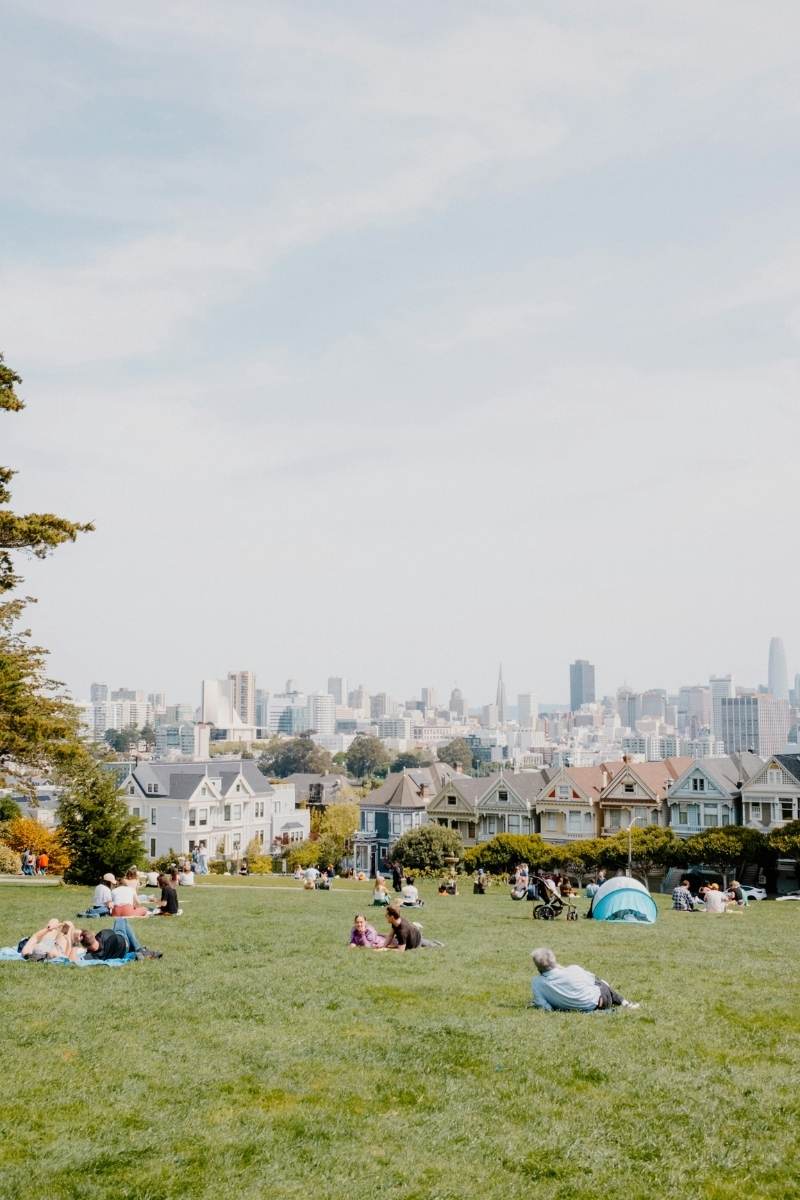
The six painted Victorian rowhouses known as the Painted Ladies, on the eastern edge of Alamo Square Park, are one of the most photographed views in San Francisco — the 1880s stick-style facades with the modern downtown skyline rising behind them. The juxtaposition of two different centuries of the city in one frame is genuinely striking, and genuinely iconic rather than merely famous.
The park itself is a pleasant urban green with views toward downtown. Visit in late afternoon when the light hits the houses from the west. The view everyone photographs is from the northern section of the park, along Steiner Street — stand lower in the park for a cleaner shot without the crowd appearing in your foreground.
The Embarcadero & the Bay Trail
The waterfront promenade from the Ferry Building to the piers offers a different kind of view: the Bay Bridge in both its spans (the western suspension span is famous; the eastern self-anchored span, installed in 2013, is a genuinely extraordinary piece of engineering), the bay traffic, Treasure Island ahead, and Oakland across the water. The Bay Bridge lights up at night with an LED installation (a permanent art installation by Leo Villareal called The Bay Lights) that turns the western span into something extraordinary after dark.
The Ferry Building itself — a restored 1898 Beaux-Arts terminal — hosts a farmers market on Tuesdays, Thursdays, and Saturdays, with local produce, coffee, and the city's best oysters available starting at 8am. Eat them on the terrace with the bay in front of you.
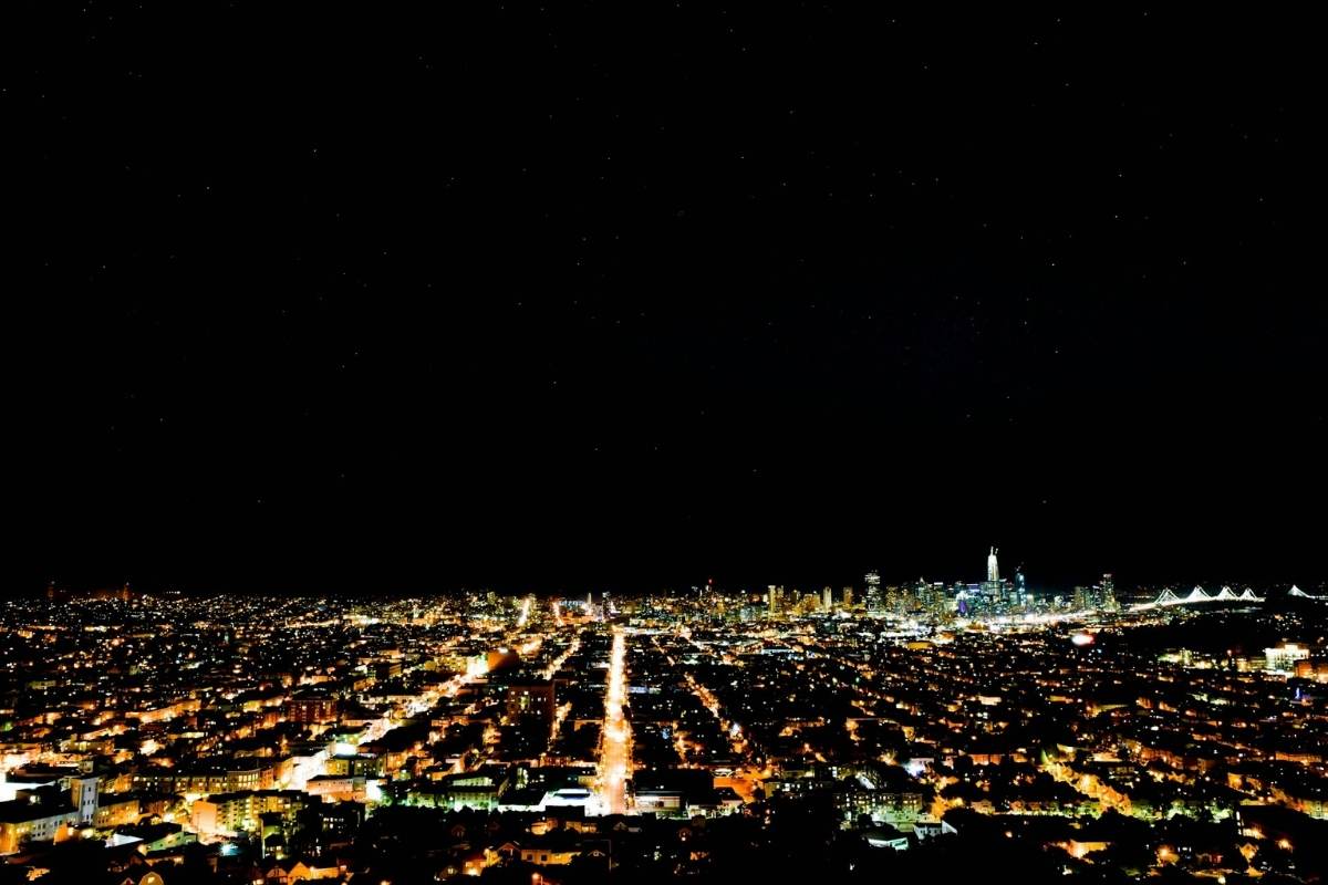
Views at Night
The Bay Bridge from the Embarcadero: The Bay Lights installation runs nightly. Walk along the waterfront east of the Ferry Building for the full span.
Coit Tower: The tower (210-foot Art Deco column on Telegraph Hill) has an observation deck reachable by elevator (small fee) or 236 steps, with night views over the city and bay. The WPA murals on the ground floor — painted in 1934 by 27 artists influenced by Diego Rivera — deserve as much attention as the view. Entry fee for the observation deck; the murals are free.
Twin Peaks after dark: The city spread below the summit at night is remarkable. The Marine layer glows orange-white from the city lights beneath it. Extremely cold. Worth it.
Practical Notes
Fog: San Francisco's famous marine layer is most persistent in summer (June–August), when the bay's cold water and inland heat generate dense afternoon fog that rolls in from the coast. Counterintuitively, September and October are often the clearest months of the year — locals call it the real summer. If you're specifically coming for views, aim for late summer through autumn.
Weather at viewpoints: The hilltops and coastal bluffs are five to ten degrees colder than downtown and significantly windier. A light layer is never wrong; a windbreaker at Hawk Hill is essential.
Getting around: The city's public transit (MUNI) reaches most in-city viewpoints. A Clipper card or the MuniMobile app covers the fare. For the Marin Headlands and Hawk Hill, you need either a car or a bicycle that can cross the Golden Gate Bridge (the walk across takes about an hour). The PresidiGo shuttle covers the Presidio.
Car break-ins: San Francisco has a serious and persistent car break-in problem. Leave nothing visible in any parked car, at any viewpoint, including the trunk. This is not a casual warning.
Timing: Sunrise on the hills is exceptional and usually crowd-free. Sunset at Hawk Hill, Twin Peaks, and the Presidio overlooks draws crowds but produces extraordinary light. Midday is the worst time for most of these spots — both photographically and logistically.
A Route Worth Walking
Start at the Ferry Building for breakfast and oysters. Walk the Embarcadero north to Fisherman's Wharf, then continue west along the waterfront into the Presidio. Follow the Golden Gate Promenade through Crissy Field to the bridge. Walk across the bridge — the pedestrian path on the east side is open daily — and take the exit to the Marin Headlands. Follow Conzelman Road up to Hawk Hill. Watch the view change as the afternoon light moves across the bay. Come back over the bridge at dusk.
This is a full day. It is also, by any measure, one of the great urban walks in the world.
Final Thought
San Francisco's views are not always available. The fog is real, the wind is real, and the drive to a hilltop that disappears into white cloud the moment you arrive is a genuine risk. Come back the next morning. The city rewards patience with something that very few places on earth can offer: a view of a great city from the hills around it, with the Pacific behind you and the bay in front, and a bridge that catches the late afternoon light in a way that no photograph has ever fully managed to convey.
Bring a layer. Go early. Go back.


